History Written into Volcanic Rock
While exploring the rural interior of Terceira Island in the Azores, particularly around São Brás, Fontinhas, and nearby upland roads, attentive walkers sometimes notice something unexpected beneath their feet: deep, parallel grooves carved directly into solid volcanic stone. They resemble rails, or the worn tracks of some long-vanished machine, and once seen, they are hard to ignore. Many visitors walk past them without realizing they are standing on one of the island’s most quietly revealing historical features.
These markings are commonly known as the stone cart tracks of Terceira Island. Although they are not highlighted on maps or marked with signs, they represent one of the clearest physical traces of how people once moved goods across the island. Far from being decorative or symbolic, they are practical marks left behind by daily life.
This guide brings together what is currently known about them — historically, scientifically, and practically — in a clear and accessible way. The goal is not to speculate or sensationalize, but to help visitors understand what they are seeing and why it matters.
What Are the Stone Cart Tracks?
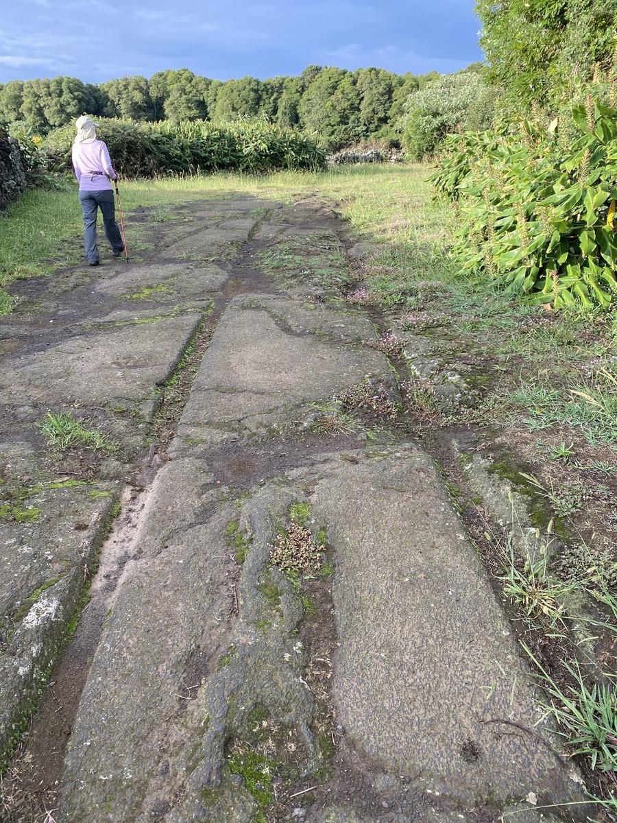
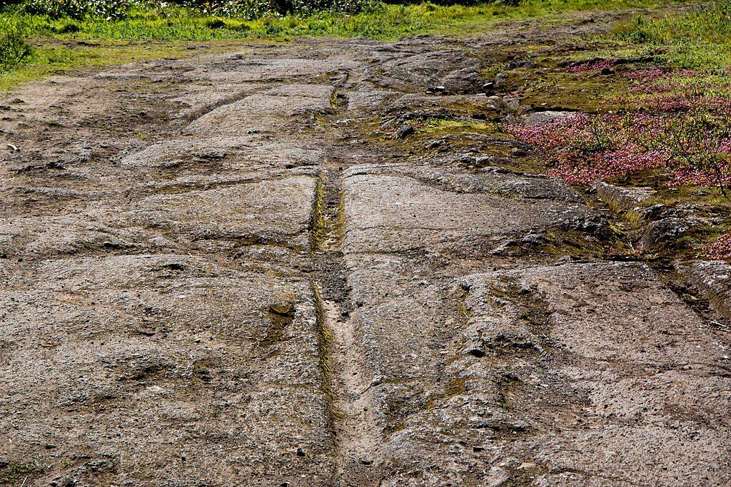
The stone cart tracks are parallel grooves worn into exposed basalt, the dominant volcanic rock of Terceira Island. They almost always appear in pairs and follow the line of old rural paths, particularly on slopes where control and traction would have been essential. In some locations, the grooves are faint; in others, they are strikingly deep and well defined.
They are not natural cracks or random erosion patterns. Their spacing, alignment, and repeated pairing show that they were created through long-term human use, not sudden geological events. Once you recognize the pattern, it becomes clear that these grooves follow intentional routes rather than accidental formations.
How the Tracks Were Most Likely Formed
The most widely accepted explanation is also the simplest.
Before modern roads and vehicles, Terceira relied heavily on wooden, ox-drawn carts to move stone, timber, crops, and other agricultural goods. These carts often used iron-rimmed wheels, which repeatedly followed the same narrow paths through the countryside. Over time, even very hard stone begins to yield under consistent pressure.
As shallow ruts formed, they naturally guided later carts along the same line. Iron rims, moisture, grit, and heavy loads worked together, slowly deepening the grooves. What we see today is not the result of a single era or moment, but the accumulated wear of generations using the same practical routes.
Why the Grooves Are So Deep
At first glance, the depth of some grooves seems surprising, especially given the hardness of basalt. However, basalt weathers gradually in the humid Atlantic climate of the Azores, particularly when water and fine grit are present. Add repeated iron-on-stone contact, and erosion becomes more effective than one might expect.
These were not occasional paths used once or twice a year. They were working roads, traveled repeatedly as part of everyday rural life. Over long periods, small amounts of wear add up, leaving behind the deep tracks still visible today.
What Science Says About Their Age
There is no single confirmed date for when the stone cart tracks were first formed. However, an important 2018 scientific study, led by Rodrigues, Madruga, Martins, and Cardoso, examined several cart-track sites on Terceira Island in detail. The researchers approached the question cautiously, focusing on evidence that could be reliably analyzed.
Rather than attempting to date the rock itself — which is not possible using carbon dating — they analyzed organic material found in sediments within the grooves, such as soil that accumulated over time. Their results showed evidence of human activity in the area dating back roughly 1,000 years.
This finding is often misunderstood. It does not prove that the tracks themselves are that old, nor does it suggest settlement before the well-documented Portuguese arrival in the 15th century. What it does show is that these routes were important enough to be used, reused, and preserved across long spans of time.
Why the Tracks Are Not Signposted or Classified
Despite their visibility, the stone cart tracks of Terceira Island are not formally classified as an archaeological monument. This is not unusual and does not reflect uncertainty about their human origin.
Across Europe, similar cart tracks exist in mainland Portugal, Spain, Malta, and Italy, where they are generally understood as historic infrastructure rather than ceremonial or symbolic sites. Features tied to everyday transport are often left unmarked, even when they played a central role in shaping the landscape.
Relationship to Quarries and Rural Life
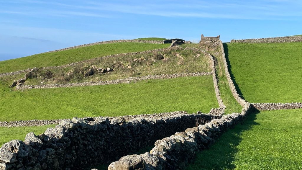
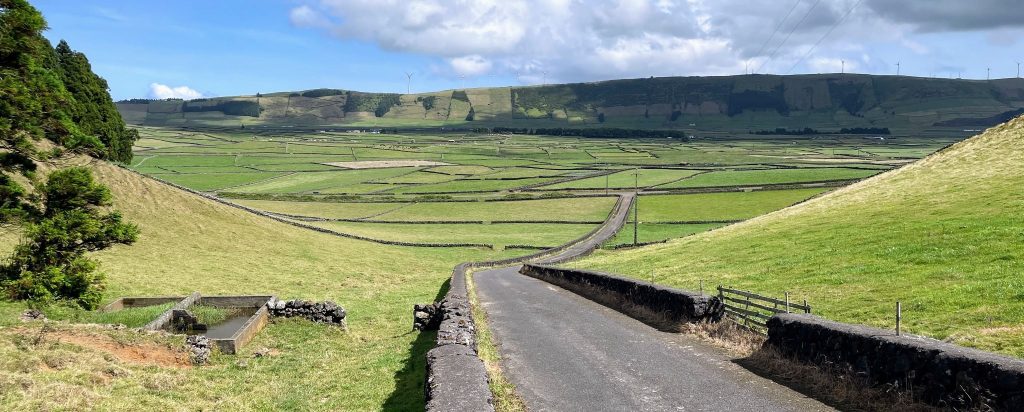
The placement of many tracks aligns closely with areas historically associated with stone extraction, agriculture, and rural settlement. Their direction and slope often make practical sense, particularly for moving heavy loads downhill toward villages and returning uphill with lighter carts.
Seen in this context, the tracks fit naturally into what is known about Terceira’s pre-modern economy. They are reminders of how closely movement, labor, and geography were connected on an island shaped by farming and construction.
Why These Tracks Matter Today
The stone cart tracks are not a puzzle that needs solving. They are physical evidence of everyday work, preserved directly in the landscape rather than behind museum glass. They show how practical decisions made centuries ago still guide movement across the island today.
Many modern roads follow these same paths, tracing routes that proved efficient long before asphalt existed. Recognizing the tracks adds depth to even a simple walk or drive through the countryside.
How to Find the Stone Cart Tracks
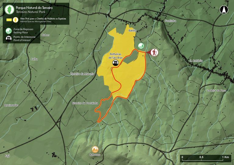
The stone cart tracks are part of the Relheiras de São Brás area on Terceira Island. There is no visitor center, no ticket booth, and no sign by the road announcing what you are about to see. As with many historic landscape features on Terceira, knowing where to look — and what to search for — matters more than following signage.
The simplest way to reach the area is by using Google Maps. Search exactly for “Parque de Merendas de São Brás”, which may also appear in English as “São Brás Picnic Area – Terceira.” This small picnic area is where most visitors naturally park, and it provides an easy and respectful access point to the surrounding paths.
From the picnic area, walk toward the nearby dirt and stone paths that lead into the Relheiras de São Brás (PRC08 TER) trail network. There is no need to follow the full marked trail. Within a short walk, the surface transitions from pavement to earth, and then to exposed volcanic rock. It is here — directly beneath your feet — that the cart tracks become visible, carved into the stone exactly where they have been for centuries.
For those who prefer coordinates, entering 38.7605, -27.1408 into Google Maps will bring you to the same general area. There is no gate and no formal trailhead sign. The experience is understated by design, and that simplicity is part of its appeal.
The moment often surprises first-time visitors. One step you are on an ordinary rural path; the next, you are standing on a working surface shaped by generations of movement. Seeing the tracks in person makes their purpose immediately clear in a way photographs never fully capture.
Visiting the Stone Cart Tracks Today
If you encounter these grooves while walking or driving, take time to observe them carefully. Avoid stepping directly inside the tracks where erosion continues, and never attempt to clean or alter them.
Once you know what to look for, you’ll begin to notice them in more places than you expect — quiet, enduring reminders of how Terceira Island was shaped, one cartload at a time.
Learn more about Terceira Island with this interesting article about the roads of Terceira.
Drive Terceira: An Atlantic Island Paradise With More Roads Than You’d Ever Expect